The complexity of visualizing the negotiated spatiality situated between memory, imagination and trauma across the years between 2003 and 2020 for Iraqis has required a palimpsest method of deep mapping that cut through conceptual, spatial and geographical layers of information. Maps produced conceptualize the spatial storytelling of Iraqis with lived experience of war and violence through affective layers of identity, belonging and memory-work. These maps capture moments of temporary meanings, however stretched these moments may be, yet they perpetuate thick descriptions of trauma that are always in the making as memories are remembered, relived and retold, highlighting their performativity.
Each of the elements of the maps has been composed not only to visualize oral histories but to capture moments lost in the chaos of trauma and violence that have never been documented this way before. Interviewees often recalled that they regret never documenting through films or photographs the traumatic events as they were unfolding before their eyes. These counter maps act as a cathartic process of capturing visually these stories before they flee from people’s memories. The fifteen deep maps are accompanied by short descriptions and vignettes from which journeys of rupture are illustrated throughout Iraq. Each map includes a three-dimensional interpretation of a spatial trauma that was recalled.
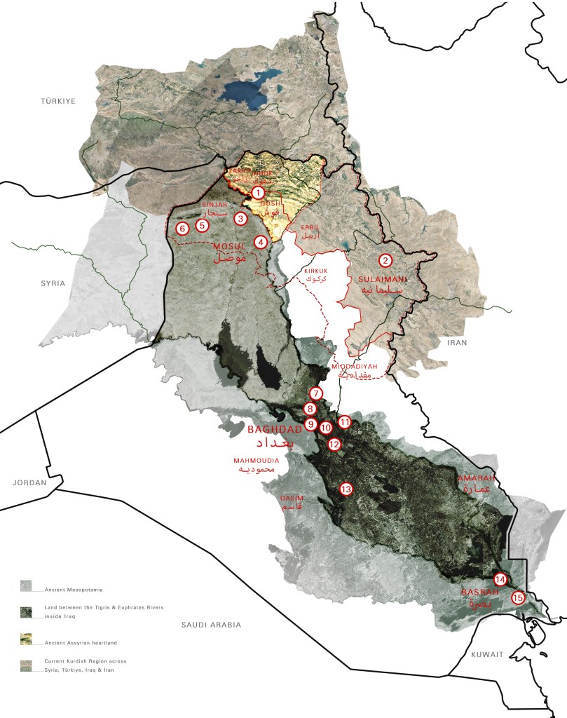
The fifteen maps are accompanied by a geopolitical map of Iraq that traverses time. This map is shrouded by the layers of history that have shaped the land since the making of modern Iraq from the original land of Mesopotamia. In addition to marking the locations of the fifteen maps, the map of Iraq also shows internal divisions and soft borders that cut through the Nineveh Plains driving a wedge in the history of the region with contested territories of origins and belongings. On this map, all localities of trauma and places of mobility, shared by Iraqis, are marked alongside the two rivers: Tigris and Euphrates.
Maps were produced using Open Source software whenever possible such as OpenStreetMaps, Snazzymaps.com and OpenAI as well as GoogleEarth that are later designed, manipulated and collaged (physically and digitally) through several iterative processes of development. Participants shared stories and photographs which became part of the composition of their maps.
